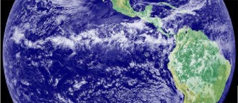
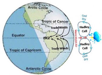
Warm, moist air, which is heated by solar radiation, rises vertically near the equator. As it rises, it cools and condenses, causing heavy rainfall. The rising air then travels north or south towards the poles and dry, cooler air descends near the tropics, before heading back towards the equator, in an atmospheric circulation pattern known as the Hadley Cell. The air which heads back along the surface of the earth towards the equator forms the trade winds. The trade winds blow mostly from the north-east in the northern hemisphere and from the south-east in the southern hemisphere and they converge near the equator in a zone called the ‘Inter-tropical-convergence zone’, or ITCZ for short. From space, the ITCZ appears as a band of thick and thunderous clouds which circle the earth around the equator.
The exact location of the ITCZ varies over time, but generally it oscillates north and south of the equator depending on the season. The ITCZ movement is generally greater over the land than over the sea. Over the land, the ITCZ moves north during May to July to around a latitude of 7 degrees North, and south during November to January, placing it well over the Amazon basin. The variation in the location of the ITCZ affects the wet and dry seasons of the tropics.
The oscillation of the ITCZ over the coast of Guyana causes the two wet-seasons experienced around June and December. Based on long-term rainfall records from 1892, average rainfall in Georgetown is about 2304 mm per year but can be as high as 3750 or as low as 1340 mm per year.
In the savannah region in north-eastern Brazil and southern Guyana however, the annual rainfall pattern exhibits a single wet season centered in June and a single dry season centered in December as a portion of the ITCZ over the land is mainly over Brazil at this time. Rainfall in the savannahs is significantly less with Lethem having about 1300 mm rainfall a year.

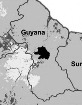
The Iwokrama forest is located in the centre of Guyana just north of the 
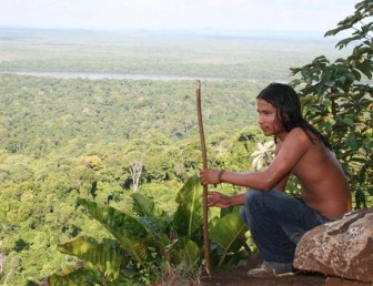
Rain forests are rich in biodiversity and are home to many different plants and animals as well as indigenous communities. Humans, even those who don’t live in the rain forest, rely on it for resources such as building materials (wood and lianas), medicine and fruits.
Rain forests also provide essential environmental services for life on earth; they create soil as well as prevent soil erosion, produce oxygen though photosynthesis, maintain clean water systems, and are a key defence against climate change.

Cell, the ITCZ and the
trade winds
The Iwokrama Rain Forest is 371,000 hectares, located in the heart of Guyana. Our mission is to develop strategies for conservation and sustainable development for local people in Guyana and the world at large. We are involved in timber, tourism and training. Come and visit us in the rain forest or at http://www .iwokrama.org.

to the savannahs (pale area)


