By David A Granger MP, Leader of the Opposition
The expulsion of an unarmed, seismic survey vessel from Guyana’s exclusive economic zone by a Venezuelan naval corvette was a dangerous and egregious exhibition of gunboat diplomacy.
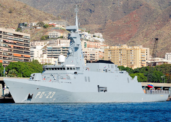
The corvette–Yekuana – of the Armada Bolivariana de Venezuela (Bolivarian Navy of Venezuela) expelled the seismic survey ship – TeknikPerdana – from Guyana’s EEZ under threat of force on Thursday, October 10. The Yekuana instructed the Perdanato to proceed into Venezuelan waters where the vessel and crew were detained.
The Yekuana incident constituted a threat to international peace. It violated the Charter of the United Nations. Venezuela has relentlessly claimed the entire Essequibo region of Guyana. It still insists on referring to the Essequibo in its publications and charts as the zona en reclamación. It still attempts to appropriate the waters off the Essequibo coast in defiance of international law.
Venezuela, under President Raúl Leoni Otero, placed an advertisement in the Times newspaper of London on June 15, 1968 to the effect that the Essequibo belonged to Venezuela and that it would not recognise economic concessions granted there by the Guyana Government. President Leoni then issued Decreto No. 1.152 of July 9, 1968 purporting to annex a nine-mile wide belt of seaspace along Guyana’s entire Essequibo coast and requiring various agencies, including the Defence Ministry, to impose Venezuelan sovereignty over it.
Guyana suffered another maritime reversal in July 2000. President Hugo Rafael Chávez Frias issued a blunt rejection of the agreement between the Government of Guyana and Beal Aerospace Corporation of the United States to establish a satellite launch facility in the Waini, part of Guyana’s territory claimed by Venezuela. His Minister of External Affairs José Vincente Rangel followed this by announcing that Venezuela would begin granting oil concessions in Guyana’s Essequibo region.
Guyana, therefore, has long recognised that Venezuela’s aggression has hindered the development of its five Essequibo regions– Barima-Waini; Pomeroon-Supenaam; Cuyuni-Mazaruni; Potaro-Siparuni and Upper Takatu Upper Essequibo – through lost foreign investments and blocked projects. Guyana had to seek safety beneath the shelter of international law if it was to guarantee its territorial security and attract foreign investment in a competitive international environment.
One of the first legislative initiatives that reflected Guyana’s anxieties about security and sovereignty was the enactment of the Maritime Boundaries Act on June 30, 1977. The National Assembly later unanimously approved a resolution on November 10, 1993 which endorsed Guyana’s ratification of the United Nations Convention on the Law of the Sea (UNCLOS) and its deposit of the 60th Instrument of Ratification on November 16, 1993, enabling the Convention to enter into force a year later.
Guyana also took steps towards the consolidation of sovereignty over its marine resources with the introduction of the Petroleum (Exploration and Production) Act, 1986 which became law on June 14, 1986. Licences have been issued under the Act, from time to time, for foreign companies to conduct exploration activities. All the areas in which foreign companies were granted licences to conduct exploration were located in the EEZ claimed by Guyana. Bilateral fishing agreements allowing foreign vessels to fish in Guyana’s waters were also made without challenge or protest.
A large expanse of hydrospace – an area of about 130,300 km² or three-fifths of the size of its land space – was brought under Guyana’s jurisdiction as a consequence of the Convention and in accordance with the state’s own Maritime Boundaries Act 1977. Guyana’s National Assembly enacted legislation and the Government made regulations which were enforced through the courts and by various arms of the state. Sovereignty and jurisdiction, therefore, were exercised openly, continuously by these executive actions.
The importance of the Convention to Guyana’s sovereignty and security has been apparent for decades. Guyana gained from the Convention in three important ways. First, its geographical location, facing the open Atlantic Ocean, permitted it to claim a territorial sea, continental shelf and fishery and exclusive economic zones to their full extent. Second, economic benefits could be enlarged by greater access to commercially exploitable living and non-living resources of the EEZ. Third, its geographic position supported its claim to access the resources of the outer continental shelf.
Guyana,therefore, has taken decisive actions “to manage, preserve and use the resources and activities of its coastal region and Exclusive Economic Zone (EEZ) to further [its] economic and political well-being while preventing the occurrence within that area of acts inimical to its welfare.”
Venezuela’s claims to over 150,000 km² of Guyana’s landspace and a large part of its hydrospace have their origins in its rejection of the 1899 award of the international tribunal as a nullity. The land boundary, subsequent to the award, was surveyed and the details embodied on maps and certified by agreement of January 10, 1905. The maritime boundary, however, was never formally defined.
Venezuela’s maritime excursions in Guyana’s EEZ are based not on international law but on sheer naval power. Its pre-eminence derives from its possession of the longest Caribbean coastline of any state (2,718 km); a sizeable continental shelf which is rich in petroleum and other mineral resources; abundant living resources; numerous natural harbours; extensive maritime transport and transnational economic activity and its strategic location as a link between the North and South American continental land-masses.
These attributes have been reinforced by its economic wealth, arising mainly from petroleum revenues. They have been bolstered, also, by its maritime power derived from the size of its naval, fishing, merchant marine and oceanographic scientific research fleets. Not least of all is the fact that Venezuela laid claim to the single largest exclusive economic zone, which comprises 37 per cent of the Caribbean Sea.
Venezuela’s quest for maritime power has been evident over the past seven decades from the time of the Anglo-Venezuelan Agreement of the Gulf of Paria of 26th February 1942. Venezuela’s Act Concerning the Territorial Sea, Continental Shelf, Fishing Protection and Airspace of July 23, 1956 had the effect of establishing a 12-mile territorial sea. Corresponding control over the seabed and airspace were explicitly claimed along with a contiguous zone of three miles and continental shelf jurisdiction. Difficult situations arose, however, when the idea of the 200-mile Exclusive Economic Zone became entrenched in the Convention. Venezuela’s central location in the Caribbean, and its far-reaching claims, made delimitation arrangements with several other states necessary.
Venezuela voted against the adoption of the United Nations Convention on the Law of the Sea.It thereupon embarked on an aggressive campaign of bilateral negotiations to fulfil its maritime ambitions. Its Ministry of External Relations established a high-powered technical team comprising economists, geologists, marine biologists, geographers, cartographers, international lawyers and naval officers to work on the negotiations of its boundaries with its neighbours in the Caribbean Sea.
Venezuelan relentlessly pursued its national interests, often to the disadvantage of third parties excluded from its bilateral negotiations. One such example of this bilateral tactic was the Treaty Between the Republic of Trinidad and Tobago and the Republic of Venezuela on the Delimitation of Marine and Sub-Marine Areas of April 18, 1990. Both states sought to project their own interests without resorting to a more appropriate multilateral mechanism which the particular situation warranted.Venezuela sought a strategic access to the ocean – salida al Atlántico– and Trinidad and Tobago sought access to new areas of potential hydrocarbon resources. The point has been made, however, that the area of concern is bordered by four states – Barbados, Guyana, Trinidad and Tobago and Venezuela – not by the latter two alone.
Guyana’s seaspace security cannot be guaranteed without the satisfactory delimitation of its maritime boundary with Venezuela. The regimes of the territorial sea, exclusive economic zone and continental shelf under the United Nations Convention on the Law of the Sea assume that some attempt would have been made by adjacent coastal states to negotiate an agreement.
The delimitation of Guyana’s maritime boundary can be determined permanently and satisfactorily except under international law. Gunboat diplomacy – such as October’s Yekuana incident –has no place in relations between Venezuela and Guyana in the twenty-first
century.


