A Berbice-based group of engineers had proposed a long-term solution to the problematic areas along the East Bank of Demerara (EBD) which are threatened by the nearby river but the group’s ideas were never considered.
The Caribbean Outlook Foundation, a non-profit organization made up of experts in the field of engineering, in the early 1990s had approached then President Cheddi Jagan with a blue-print of a plan which would have seen the Demerara River being reclaimed using Dutch technology.

PRO of the group Edwin De Barros told Stabroek News recently that the group’s president Suruj Motilall had discussed the organization’s proposal with Dr Jagan but the head of state said at the time that the government was new to office and did not have the resources to finance such a project.
He said that the project proposal had been reviewed extensively by the organization and he noted that if the plan was or still is considered works would be undertaken at a significantly lower cost in the long run. He said that the current works being undertaken at Craig on the EBD are being done without a futuristic plan, noting that the geography of the area has to be analyzed.
He said that Motilall, who is based in Holland and who oversees numerous infrastructural projects in Europe, had undertaken surveys at Craig more than a decade ago but he noted that considerations at the time centred on financing of a project for the area. He noted however, that the authorities should consider a long–term solution to the area.
The plan
He said that an aspect of the group’s proposal centred on Holland-technology being utilized to reclaim the land adjacent to the river banks at Craig, from the Demerara river. He explained that three aspects of the pressure of the water flow in the river have to be first considered and these will be mapped to determine the best type of interlocking-concrete piles which can be installed in the area.

He said that the piles can be sourced at a cost of $300,000 each and can be made locally or sourced from overseas, but the latter may be costly, he added.
De Barros added that while various sizes of piles can be used, piles of size 50 feet in length by 12-14 inches in width can be utilized. The piles would be designed in such a manner than when installed into the earth, the top, which would remain on the surface, would “be like a table top 4 feet broad”. The tops will be connected, “so that when completed you can have a flat concrete surface…they will interlock.” He said that the form of technology would leave room for any adjustments to the structures when installed.
He said that the plan was designed to reclaim the land from the river by any distance, noting that as much as 200 feet can be reclaimed.
Reclamation
He explained that the reclamation aspect of the project is technical and he gave a brief description of how it can be undertaken.
He said that after the piles are driven into the area some distance away from the river bank, the area between the piles and the end of the land would be back-filled with mud. He said earth in the immediate vicinity of the river floor can be “scooped up using an excavator on a pontoon” for this purpose and he added that the latter would be good for the general water flow of the river.
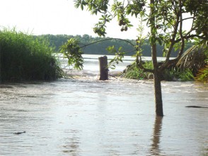
De Barros said he recently saw pictures in the Stabroek News of an area at New Hope along the Demerara River which is being threatened and he noted that the blueprint which the organization has covers the entire East Bank area from Houston to Timehri. He said that the problem at New Hope is similar to what is being experienced at Craig and he noted that the seepage of water is the central factor. He said that “once water keeps seeping through the revetment it will wash away the mud and eventually reach the road…it will soften the mud in the process.”
De Barros explained that the organization had also undertaken feasibility studies at an area at Skeldon on the Corentyne, close to the Muslim Mosque and the Skeldon Market which is experiencing a similar problem, the area is being threatened by the nearby Corentyne River.
De Barros stated that members of the organization have overseen many aspects of infrastructural works around the world including South Africa, Suriname and parts of Europe. He said that group is currently providing assistance in the rehabilitation of infrastructure in disaster-ravaged Haiti.
Cabinet recently cleared a $64.8M contract for the construction of greenheart revetment at Craig.
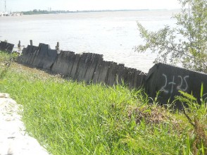
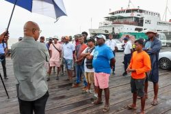
When Stabroek News visited the area a few weeks ago, works were being undertaken by the contractor. It was evident that the revetment works previously carried out had sunk under the river banks and residents noted that while revetment work is a possible solution, a more viable solution should be undertaken in the long run. There have been concerns that this $64.8M could literally money washed down the drain.
Persons there stated that the revetment initially started to rot, and over time with heavy silt building up under the base of previous works, the entire infrastructure began to fold over into the river.
Two sections of the revetment appeared to have slipped under the river over the years and the level of the river, one resident noted, has risen in recent times.
It was also noted by the experts that most of the main rivers in Guyana run in a north to south direction, with only the Ireng River which lies on the Guyana/Venezuela border running in a southerly direction.
With heavy rainfall in hinterland areas, and global warming taking affect, a large volume of water flows down the tributaries of the Demerara River annually.
The resultant effect has proven to be flooding in several areas, such as at Kwakwani and its environs, and as water levels rise worldwide, it was posited that in a few decades persons living on the coast may experience frequent floods.


