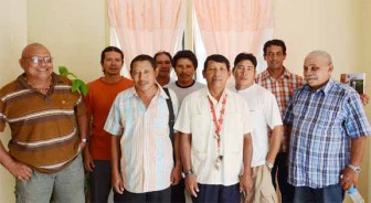
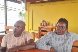
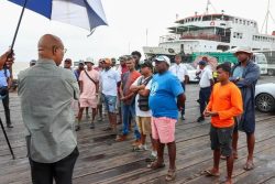
The people of the Wapichan communities of South Rupununi on Tuesday unveiled a digital map of their traditional territories along with a plan that if successfully implemented would protect 1.4 million hectares of pristine rainforest, while preserving their cultural, linguistic and historic heritage.
The digital map of the area in the South Rupununi District of Region Nine—which is the homeland of 20 Wapichan communities—has been in the making for 10 years. It is part of a long-standing campaign to have their rights to their traditional lands legally recognised, according to the South Central People’s Development Association (SCPDA).
According to that body, the entire Wapichan territory in Guyana is threatened by mega road and dam projects as well as external plans for logging, mining, and agribusiness development. They are concerned that like many other parts of the Amazon basin and the Guiana shield, the Wapichan communities are vulnerable to land grabs and marginalisation because they lack secure legal title over much of their traditional lands.

Speaking on the potential benefits to the people of the Wapichan nation, Kid James, a member of the SCPDA said that having security in the ownership of their land would afford them the opportunity of living comfortable lives as Wapichan people being able to continue their traditions and their relationship with the mountains, rivers and forests.
The project is aimed at ensuring that everything regarding the preservation of land rights and cultural rights is done in a systematic way and that future generations would not only benefit from it but also build on it, the group said. “Culturally, the relationship with the forest, waterways and mountains will remain strong,” said James.
Further, James said, the Wapichan peoples are exercising care in the way they exploit their resources, such as fish. “We say when we should be fishing and when we should not be touching them,” he added that this is to ensure that there is food security. “We know that there is something amiss when we don’t see a certain bird or certain trees flourishing,” he said, emphasizing on the importance of traditional knowledge to the people of the Wapichan communities.
James said the Wapichan people need the help of donors, conservationists and government to ensure that their project is successful and sustainable. He said that some of the challenges to the project include communications between the various communities and deciding on what to do to ensure that development projects that could potentially be bad for the biodiversity of the area are evaluated. “We are looking at how we deal with free, prior and informed consent. We have been speaking on how we give consent to people coming to do research and development projects,” he said.
James said the plan is grounded in and guided by the tribe’s customary laws and is aimed at the passing down of traditional knowledge from generation to generation.
Toshao Patrick Gomes, Chairperson of the South Rupununi District Toshaos Council, told Stabroek News yesterday, “We want to secure our traditional lands so that our customs and traditions could continue.” He said that it is the first time in Guyana that indigenous peoples have mapped their own land by themselves.
Gomes said they created the maps so that they would have a visual depiction of the places they discuss among themselves at their various meetings within the Wapichan communities. “Especially where we had to go from village to village and explore common boundaries,” said Gomes.
The elderly Toshao said all of the meetings were conducted by teams who were bilingual in English and the Wapichan language. In this way, people felt more comfortable speaking in their native language and much richer information came out because of this.
According to Gomes, some of the areas under the control of the Wapichan people will be proposed as conservation areas. Many of the areas proposed are those where people from the coast go to hunt.
Gomes explained that most of the creeks have been given traditional names in the Wapichan language, ensuring the preservation of the culture.
Mapping is a tool that has been used in negotiations and for seeking the recognition of rights in the South Rupununi.
Mappers from the Wapichan communities used GPS technology to map the location of key livelihood, spiritual and cultural heritage sites that hold deep importance to the people and sustain their way of life.
The SCPDA said that building on the mapping and community research to document traditional knowledge and customary land use, the Wapichan organised more than 80 community consultations, workshop and public meetings between 2008 and 2011 to create collective proposals to promote sustainable land use, support local livelihood and protect their territory against harmful development.
The proposals, compiled in a Wapichan territorial plan, titled “Thinking Together For Those Coming Behind Us,” details customary laws for caring for the land and includes over 40 community agreements to secure the community land rights, safeguard and sustainably use resources, and conserve cultural heritage and wildlife sites under community controlled reserves.
Wapichan leaders pointed out that securing the rights over their forest would not only bring important co-benefits where regional and global climate is concerned but would also facilitate implementation of the United Nations Declaration on the Rights of the Indigenous People, as well as related human rights and environmental treaties signed by Guyana.
“Recognition of our rights to control and manage our traditional territory,” Toshao Anglelbert Jonny is quoted as saying, “would be one of the best ways of helping Guyana to tackle climate change, and meet its obligations under the Convention on Biological Diversity, which aims to conserve and sustainably use biodiversity.”
The Wapichan territory has a rich variety of rainforests, mountains, wetlands, savannah grasslands and tropical woodlands, and the communities have made a living there from small-scale farming, hunting, fishing, and gathering for generations. The area also has an abundance of wildlife, including endangered species such giant river otters, jaguars, and rare bush dogs.


