The Guyana Energy Agency (GEA) says it recently completed a year and a half of data gathering in wind measurement.
Relocated from Yupukari in Region 9 (Upper Takutu/Upper Essequibo), in November of 2014 to Kumu, also in Region 9, a press release from the GEA said that the wind tower is currently gathering data in relation to wind speed and direction.
The data gathered will be of benefit in understanding and estimating the wind energy potential of each site. “The data obtained will aid in future project studies, design and development, and it will play a vital role in the planning process of wind energy projects”, the press release quoted Kenny Samaroo, the GEA’s lead Engineer on Wind Energy as saying.
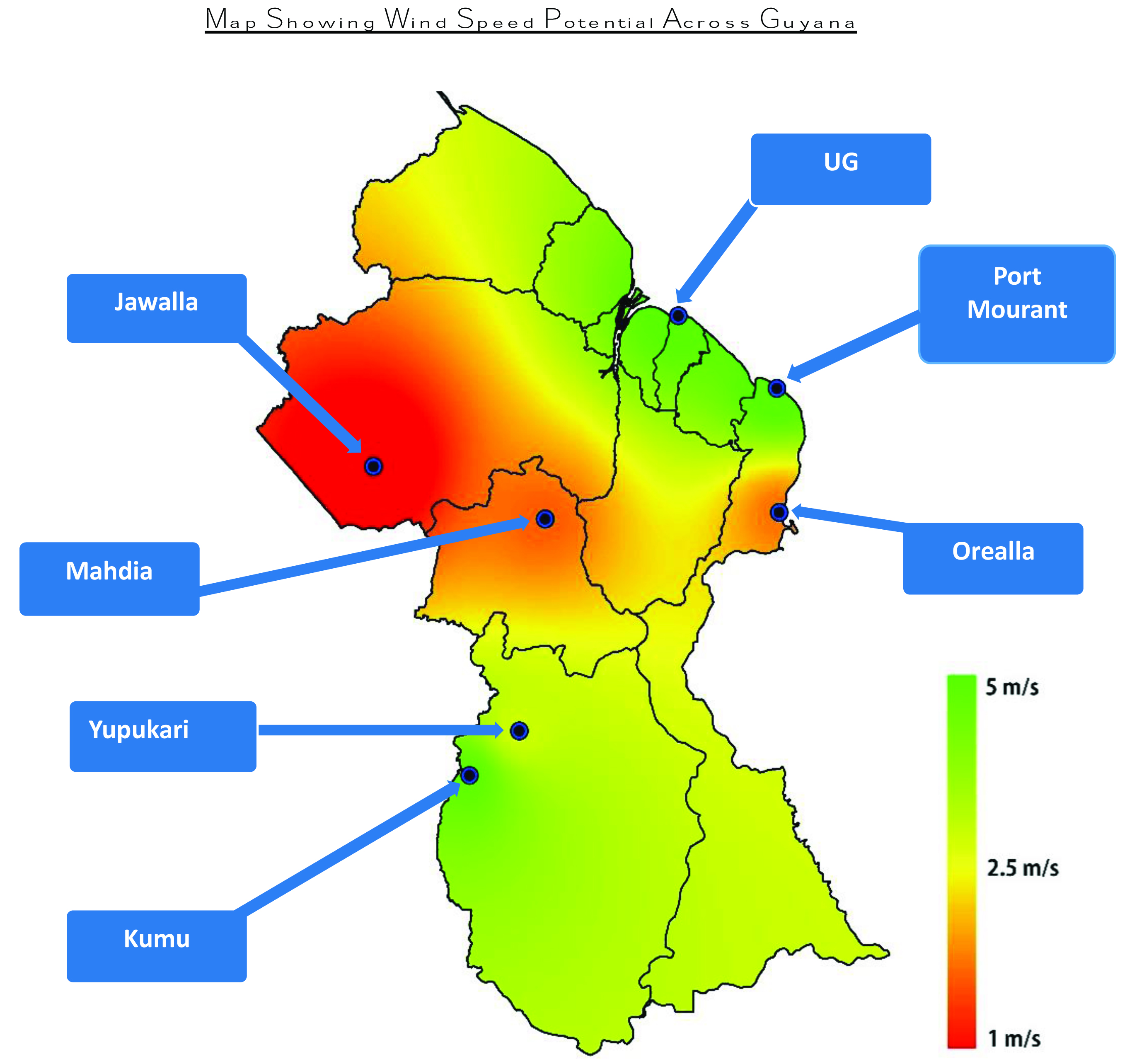
The GEA is also using the data to create a map of the intensity of the wind in the various regions/sites that wind data gathering was conducted.
The release said that the sites for data gathering are selected initially using Global Atlas for Renewable Energy along with local knowledge. Samaroo said that though information from the Atlas is used to determine testing sites as it relates to potential ‘breezy’ locations GEA consults with locals within each of the identified communities.
Once a site has been chosen, data is collected from all the promising sites within the specific region before the system is relocated to another region. The press release said that areas that will be targeted for data gathering in a new cycle, commencing in 2016, are Bartica Region 7 (relocating from Jawalla Region 7), Kato Region 8 (relocating from Mahdia) and Quarrie in Region 9 (relocating from Kumu Region 9).