Despite the loss of mangroves by natural erosion, the National Agricultural Research and Extension Institute (NAREI) says that preliminary research has recorded a net gain in acreage and a study is being done this year for a comprehensive picture.
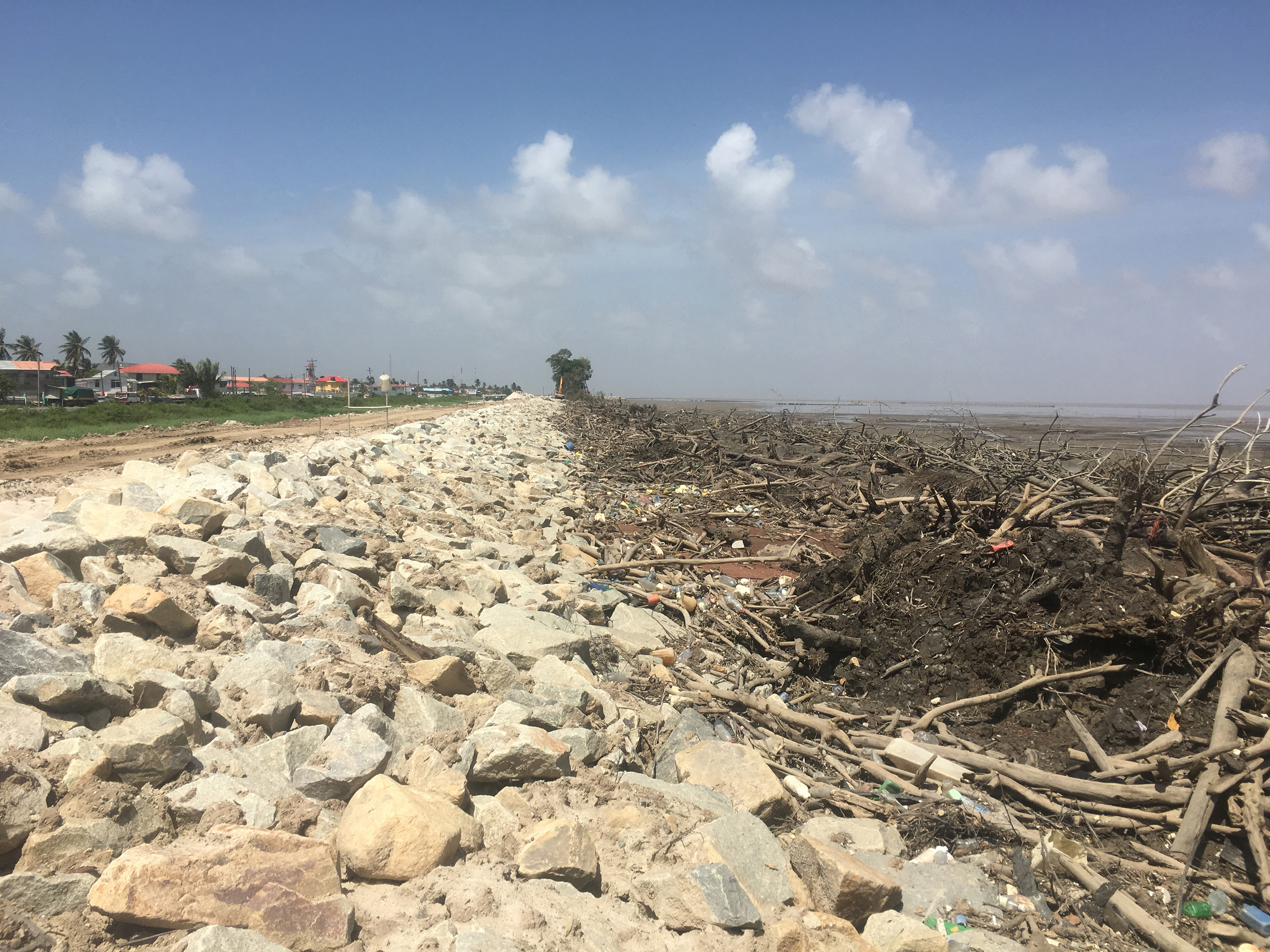
Loss of mangroves came to light recently when residents of Ruimzigt, West Coast Demerara queried why the trees which provide natural protection from the sea were being removed. The Ministry of Public Infrastructure (MPI) later disclosed that the mangroves were dying as a result of the natural erosion cycle and rip-rap sea defence was being installed. The residents had been unaware of this and meeting was later held by NAREI and others with the Neighbourhood Democratic Council in the area to explain the situation.
Speaking to Stabroek News yesterday, Kene Moseley, head of the Mangrove Department at NAREI stated that despite the current erosion along the coastline, there has been a net gain.
She noted that while they do not currently have enough scientific information to make an informed conclusion, their assessment shows that there has been a net gain because of the restoration programmes that they have been carrying out.
According to Moseley, they have ongoing restoration programmes in regions 2, 4 and 5, where they either plant seedlings or develop coastal infrastructure, such as groynes or brushwood dams, which are sediment traps.
For Region 2, works were done from Lima on the Essequibo Coast all the way to Devonshire Castle and Walton Hall. For Region 4, restoration work was done from Chateau Margot to Better Hope.
Moseley said their intervention has resulted in natural restoration taking place at Sparendaam and Plaisance on the East Coast of Demerara.
For Region 5, the West Coast of Berbice, specifically Number 7 Village all the way to Number 3 Village benefited from a restoration programme.
According to Moseley, the site in West Berbice is special because they were able to record significant natural restoration along the coastline and in the neighbouring villages.
“As a result of the restoration, we have found natural restoration taking place and the width of the forest has extended to over 300 meters,” she said, while pointing out that the area was planted in 2011 and 2012.
While there has been an increase of rip-rap sea defence works along the shore, Moseley said she does not expect mangroves to be replaced since the construction of artificial protection for the shore also promotes healthy mangrove growth.
She said that they have noticed this occurrence at Greenfield on the East Coast and will continue to monitor what is happening on the West Coast of Demerara.
In terms of having accurate data, Moseley noted that they are planning to do an assessment of the mangrove cover to update the current information. This will show whether there has been a definite loss or gain and how effective natural regeneration and other restoration methods have been.
The study, she said, is expected to be completed by the end of the year and will dictate how future sites are addressed and what methods are used.
In addition to natural erosion, she also noted that there are man-made factors that affect the mangrove population, which includes the wanton dumping of garbage along the coastline and fishermen using the trees for other purposes.
As a result, they have embarked on an awareness programme and have been holding workshops with volunteers along the East Coast of Demerara to identify how human life impacts the coastline and some of the solutions that can be employed by the communities themselves.
Moseley also emphasized that once the mangrove forest has enough width, it is possible for it to naturally restore itself when the cycle changes and there is accretion and deposition of sediment. However, the natural regeneration is only possible when there is no stress on the system.
“The coast of Guyana is part of a 1600 km-long muddy coastal system dominated by massive mud banks that migrate from the mouth of the Amazon River to that of the Orinoco in Venezuela. According to a study completed by Professors Antony and Gardel in 2013, the dynamics of the Guyana coastline are strongly hinged on pulses of mud abundance or scarcity embedded in multi-year cycles of mud-bank activity and inter-bank phases. The cyclic mud-bank phases regulate mangrove regeneration by providing a substrate for extremely rapid and large-scale colonization from older mangrove colonies and vigorous tree growth,” NAREI had said in a statement last week.
Currently, there are collaborative studies between UG’s Civil Engineering Department and NAREI’s Mangrove Restoration Programme along with the Ministry of Public Infrastructure’s Sea and River Defence Division to better understand and model the cyclic process.
“While mangroves are subjected to cyclic erosion, studies conducted on Guyana’s coastal mangroves have proven that a mangrove bandwidth of 50m-80m is required to reduce a 3m high wave to approximately 0.01meters. In the areas where mangroves are not present, severe over-topping occurs (along Kingston and Sheriff Street) which results in increased cost for maintenance works over a period of time,” Ranata Robertson, coastal engineer had said, according to the NAREI statement.