The Guyana Lands and Surveys Commission (GLSC) has signed a $93-million contract with the British firm Ordnance Survey International (OSI) to provide consultancy services to the GLSC to establish the Continuously Operating Reference Stations (CORS) network in Guyana.
The network seeks to establish and maintain, GLSC Commissioner Trevor Benn said, “a modern, robust and accurate national geodetic positioning network for Guyana.”
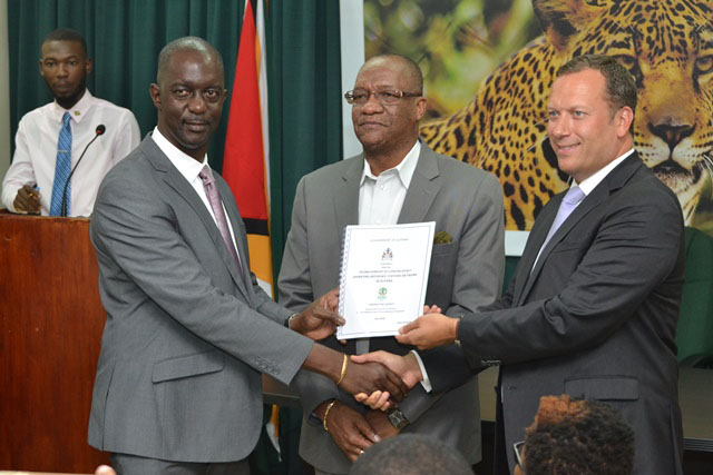
Benn and OSI Managing Director Peter Hedlund yesterday signed the contract at the Ministry of the Presidency in the presence of Minister of State Joseph Harmon at the Ministry of the Presidency, Shiv Chanderpaul Drive, Georgetown.
Welcoming the signing of the contract with the expectation that the project’s mandate will be executed according to its terms of reference, Harmon said, “the establishment of the CORS network in Guyana is a very important development as it will enable the GLSC to fulfill one of the main aspects of its mandate which is to execute or cause to be executed, geodetic, topographic, geographic and cadastral surveys in relation to land and water resources of Guyana.”
It will also help the GLSC, he said, to gather information, set targets and indicators and develop sustainable land use policies that are in line with the implementation of the Green State development strategy and the establishment of a Green State.
In brief remarks, Hedlund said, “In the industry, having a solid CORS network, is the key foundation for survey and mapping and land administration.”
The OSI, he said, had had a presence in Guyana for many years and it was good to be back.
Cabinet gave approval in June for the contract with the 227-year old OSI, Benn said.
He said the CORS project is not a new one and that it had its genesis in a project that began about seven years ago when the sum of about $0.5 billion was spent to set up the CORS network. The network was not put into use and the eight stations set up across the country became inoperable.
The contractor on the previous project was Spatial Innovision Ltd out of Jamaica.
The main aim of the current project, Benn said, is to restart the eight defunct stations in the CORS network. The stations are at Eclipse Falls (Region One), Supenaam (Region Two), Georgetown (Region Four), New Amsterdam (Region Six), Olive Creek (Region Seven), Lethem (Region Nine) and Linden (Region Ten).
The project is also expected to make recommendations for sustainable business models to use in the CORS network based on the needs of the GLCS and the various user communities.
It will also engage in training and knowledge transfer for capacity building to maintain and sustainably operate the CORS network.
It will also seek alignment with the international geodetic reference framework of the Americas.
The OSI was identified to advise the project, Benn said, because of their insight into the sustainable and future use of the CORS technology.
The CORS network, he said, is one of many strategies to support Government’s developmental trajectory towards a Green State. Another is the revision and creation of policies, including the creation of a national geospatial policy, to guide the GLSC’s work.