The Hydrometeorological Department is advising farmers in the coming weeks, to conserve water as the dynamic and statistical El Niño Southern Oscillation (ENSO) models predict weak to moderate El Niño conditions through to December, 2018.
According to a press release from the Hydro-meteorological Department of the Ministry of Agriculture (MoA), Guyana is now transitioning into the long dry season which usually lasts until the end of November for northern Guyana, and is expected to end in late April, 2019 in southern Guyana. The transitioning for northern Guyana began during the last week of July and is expect to do so for southern Guyana during the latter half of August, 2018. Therefore Chief Hydrometeorological Officer (ag) Dr Garvin Cummings is advising persons, especially farmers, to conserve water during the dry period.
“The absence of rainfall does not indicate a drought situation, but rather a period of dry spells. As a consequence, citizens are advised to conserve water until the start of the secondary rainfall season at the end of the year. Areas in the Rupununi Savannahs that rely on shallow wells and small streams for their water supply should enforce strict water conservation and storage practices during this period as flooding from swollen streams and rivers due to heavy rainfall is unlikely during this period.” Dr Cummings was quoted as saying in the media release.
Persons are encouraged to manage and closely monitor freshwater resources to ensure maximum efficiency, and to avoid the emptying of conservancies during this period. Furthermore, during periods of downpours, techniques such as water harvesting should also be practised as well as the use of water troughs, where possible, to provide water for livestock, as the probability of dry spells will increase during the season. The MoA statement added
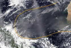
According to surface analysis, the Intertropical Convergence Zone (ITCZ) has been meandering between 5º N and 8º N. Additionally, tropical waves are recorded as passing further to the north of Guyana. These factors will continue to produce weak to moderate atmospheric instability over the country’s northern Regions (One to Four). As the season progresses, these systems will cease to affect Guyana.
Other areas of the country are currently being affected by mid-level troughs and localized conditions. During the coming weeks, these troughs are likely to give way to flows and localized conditions will become the main driver of Guyana´s weather.
According to the MoA release, while experiencing El Niño conditions, the average sea surface temperature across the Equatorial Pacific is above the climatological (long-term) average. Recent observations have shown above average sea surface temperatures across the Equatorial Pacific, but near average for the Equatorial Atlantic. The near average sea surface temperatures in the Equatorial Atlantic is currently enhancing rainfall in northern Guyana.
Output from the Seasonal Climate Outlook model for September to November, 2018 suggests that Guyana will experience the usually dry conditions experienced during this time of the year. However, there are slightly higher chances for wetter than usual conditions for northern Guyana.
Usually, northern Guyana would experience 15 to 32 rain days (days with more than 1 mm of rainfall) from September to October. However, the Seasonal Climate Outlook model suggests there will be between 15 to 34 rain days in the upcoming season and of these, up to two events can lead to extreme flooding. Temperature forecasts also suggest cooler than usual day time temperatures and warmer nights. Gradual build-up of heat can also be expected as the season progresses.