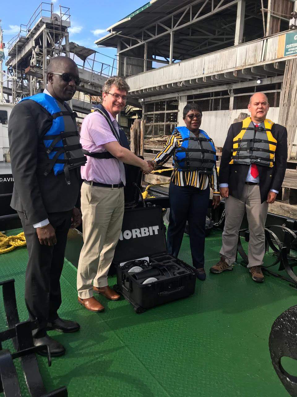
Sixty-eight million dollars’ worth of sonar equipment was yesterday handed over to the Government by the United Kingdom Hydrographic Office, and within the next three weeks, Guyana will be able to undertake undersea surveying and mapping activities.
The donation of the equipment, which includes a multi-beam echo sounder, tide gauge, sound velocity profiler and accompanying equipment, was done through the Commonwealth Marine Economies (CME) programme. The equipment will be installed on the MT Aruka.
At the handing over ceremony hosted at the Transport and Habours Department Boat House, Greg Quinn, British High Commissioner, said the new equipment will enable fishermen and mariners to have a better understanding of Guyana’s ocean floor, since much of it is unknown and unmapped.

He noted that in 2017, through the assistance of the UK Hydrographic Office, the Demerara River and the mouth of the Essequibo River were surveyed, and they were able to produce new nautical charts.
“The Commonwealth Marine Economies Programme, in partnership with the government of the Cooperative Republic of Guyana, has started to make small strides in unlocking the unknown down under the deep, blue seas—or should that be deep, brown sea in Guyana’s case,” Quinn joked.
“Going forward, work will have to be undertaken to map the constant changes which happen in a dynamic environment such as the ocean. This will ensure safe and efficient nautical navigation and support related marine activities, including economic development, security and defence, scientific research and environmental protection,” Quinn said.
He stated that the CME programme is working with Guyana to produce a Maritime Economy Plan, which will help ensure Guyana is able to sustainably develop and manage its maritime economy and increase economic growth. The plan is expected to be completed by 2020.
MARAD’s Director General, Claudette Rogers, said with this equipment, they will be in a position to compile modern navigational charts of priority areas and will improve access for commercial shipping. She also hinted that the information gathered will encourage cruise tourism, which will generate wider economic activities.
Rogers expressed her gratitude to the British Government for their assistance to the maritime department.
Eight persons from the Maritime Administration Department (MARAD) and the Guyana Lands and Survey Commission are being trained to use the hydrographic device. The training is being facilitated by Ian Davies of the UK Hydrographic department.
The persons participating in the training will be taught to analyze map readings, exposed to data gathering techniques, and taught how to use the equipment and conduct data analysis.
The British High Commissioner applauded Guyana on becoming the 90th member of the International Hydrographic Organisation, noting that the equipment will allow the country to meet its obligations of membership.
Meanwhile, in brief remarks, Davies said that the work of the UK Hydrographic Office here “aims to support the sustainable economic growth of Guyana by enabling the collection of accurate hydrographic and scientific data, as well as training to manage and develop the emerging marine economy.”
He explained that the hydrographic office will continue to offer advice and guidance to the survey team and the National Hydrographic Committee on the planning and conduct of surveys to ensure that data collected meets international standards.
Davies added that they will continue to offer tips on safety of navigation through updated charting and noted that they will be able to provide information that can be used across government to support the development and management of Guyana’s coastal waters, from fisheries to disaster management and climate change mitigation measures.