Dear Editor,
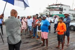
Thank you for securing information from NRG Holdings Ltd. (SN 19 July 2022, ‘Extensive consultations’ held with fisherfolk prior to Demerara dredging activities – NRG Holdings). I wonder if the sheer amount of mud to be dredged and dumped onto their traditional fishing grounds was explained by the company during the focus group meetings and public consultations with the fishermen?
I used the dimensions provided by the chartlet shown in MARAD Notice to Mariners number 113 dated 28 June 2022, derived from UK Hydrographic Office chart number 527. I assumed that the desire of EEPGL is to enlarge the Demerara Main Ship Channel to a dredged depth of 15 metres, from sea surface to sea bottom. I estimated 10 nautical miles with 10 metres of mud removed, 5 nautical miles with 7 metres of dredged mud, and 2.6 nautical miles with 5 metres of dredged mud. I estimated the enlarged channel width as an average of 2.05 nautical miles.
We cannot tell from the reported interview by Stabroek News how much of the mud from the cutter suction dredge ‘Zheng He’ will be sprayed ‘west of the channel towards the Demerara River’ and how much mud will by sucked up into the hoppers of the two trailer suction dredges ‘De Bougainville’ and ‘Galileo Galilei’ and then dumped onto the fishing grounds. But the total amount of glorious mud estimated as above comes to almost 1000 million cubic metres (= one cubic kilometre). Perhaps the G-EITI Secretariat can let your readers know who is financing this tremendous work?
Wikipedia gives the area of Georgetown as 70 square kilometres. So if the mud to be dredged and sprayed and dumped were to be overlain on the City of Georgetown it would be a layer 14 metres deep. Yet our Environmental Protection Agency does not think that this enormous movement of material and the obliteration of the natural sea bed of traditional fishing grounds needs to be explained and justified in an Environmental Impact Assessment?
Editor, I attach a scanned section of UK Hydrographic Office chart number G519B, the estuary of the Demerara River. These are the maps which are used by MARAD and Guyana’s Ministry of Finance, among other agencies. The words – ‘Demerara River / fishing stakes entry prohibited’ are clearly visible. Those words are also written on chart number G2784 which covers the estuary of the Berbice River.
Fishers have legal and customary rights; their rights pre-date those issued to the oil and gas operators and sub-contractors and service providers. Ignored though fishers’ rights are, fishers are our sentinels, witnesses to the wholesale unconsulted transformation of their fishing grounds.
Yours truly,
Janette Bulkan


