With the Environmental Protection Agency (EPA) sticking by its decision to not require an Environmental Impact Assessment (EIA) for the new Demerara Harbour Bridge, environmentalist Simone Mangal-Joly is warning against the potential impacts that a project of such magnitude can bring.
On Wednesday, the EPA launched a fresh process for the approval of a new bridge over the Demerara River and stuck to its contentious stance that an EIA is not required, even though protected mangroves will have to be removed. Additionally, it granted a 30-day period for the public to appeal the decision before the Environmental Assessment Board.
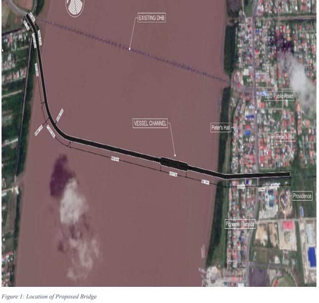
The new bridge is expected to land in the vicinity of Nandy Park on the eastern side of the Demerara River and at La Grange/Meer-Zorgen on the West Bank. Based on the information provided, the bridge is expected to land some 700 metres inland from the eastern bank of the river and will be elevated 50 meters at the beginning of the channel – which is closer to the east bank. The descent is slated to be at a rate of 5 degrees.