Land Tenure Assessments (LTAs) conducted by the Amerindian Peoples Association (APA) over the last nine years have revealed that there is widespread land insecurity among Indigenous communities in Guyana.
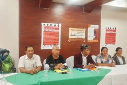
This was revealed during a virtual launch of the research titled “OUR LAND, OUR LIFE: Participatory Assessment of the land tenure situation of Indigenous Peoples of Guyana” on Thursday. The findings in the research were gathered from Indigenous villages in regions 1, 2, 7, 8 and 9.
The research, which was conducted by the APA and 49 local Indigenous researchers from the various communities, commenced in 2012 after funding became available from the European Union (EU) and the United States Agency for Inter-national Development. Technical support was provided by the Forest People’s Programme and the Rainforest Foundation US. Human rights lawyer Lan Mei, who has also been working with the APA for the past three years, provided legal support.
In brief remarks, Executive Director of the APA Jean La Rose said that the APA felt it was important to embark on such a project as a number of communities have approached them complaining that they do not fully understand the documentation for their land. Additionally, she said that in the late nineties the government had promised to deal with land issues but up to now this has not yet been done. She hopes that the government will take account of the research information now available.
Presenting the findings of the research, APA’s Governance and Rights Coordinator Laura George said that since 1969 Indigenous Peoples have recommended to the Amerindian Land Commission that customary lands should be recognised and protected.
“Our customary lands means that it is our customary tenure on how we use and manage our lands. For example, the resources we use are shared with several villages within a territory to hunt, fish and farm; to gather resources and we also are able to protect our waterways and sacred grounds,” she explained before adding that failure to recognise the territories of the Indigenous People is a violation of their rights.
Legal recognition
Key findings of the research found that there is a lack of legal recognition for titles held collectively by several villages. The report stated that in the late 1960s villages in the Northwest, the Mazaruni, Pakaraimas and the Rupununi wrote to the Amerindian Land Commission to request that the government grant them collective title. This was denied. “The failure to recognise joint territorial titles violates the right of Indigenous people to their customary forms of land tenure,” the report said.
Additionally, it was found that most of the villages’ titles do not correspond to and are often smaller in area than their traditional lands, with 77 out of 88 titled villages reporting that their titles do not secure their customary lands. George said that there is still confusion over the boundaries of titled villages and this is largely related to mistakes or inconsistencies in maps and demarcations.
She noted that it was also found that there are demarcation errors in 35 of 68 communities.
According to the report, in Mashabo Village persons have complained that the Government confused two creeks and thus demarcated the village in such a way as to cut out the piece of land between the two creeks. They believe that this error would not have been made if locals were consulted when the demarcation was being done.
In another instance, George stated that Kako Village is missing from the latest database of the Indigenous titled villages provided by the researchers of the Guyana Lands and Survey Commission and this has resulted in mining concessions being granted within the titled lands of Kako by the Guyana Geology and Mines Commission.
“Much of our research have pointed out that the failure to effectively involve community participation during mapping and demarcation is what has caused these errors,” she noted.
She added that these errors have resulted in conflicts and confusion between communities and even third parties such as miners, loggers, ranchers and other concession holders who restrict villagers’ access to their farming, hunting, fishing and gathering areas. This is also one of the key findings of the research and George reported that the extractive industries have caused significant damage to land and cultural heritage sites. She noted that these activities are out of control of village councils or the government because when challenged, there is nothing legal that can be done by councils as those lands are not titled. She added that in some areas, these type of conflicts have escalated to the point of destruction and violence. One such example is miners destroying the home of an elderly woman in Karisparu because she refused to leave so that they could mine on her property.
George stated that these conflicts will continue unless a system is put in place to address those type of issues.
Clarity
Another key finding is the lack of clarity of land titles. According to the report, the issuances of titles with ‘save and except’ clauses and other imprecisions in title boundaries has compounded many land and resource conflicts. George contended that the land title is merely an illusion as it does not give villagers the right to mineral resources, waters and subsoil. She noted that it is important to recognise indigenous rights as the GGMC will continue to grant concessions for the extractive activities to take place.
One of the consistent recommendations heard by researchers from the communities they visited was to revise the Amerindian act to ensure that it is in line with the International Standard for the protection of Indigenous Peoples rights. She noted that it was recommended that villages be allowed to hold collective title over their territory, should they chose to do so and also, ensure that land titles correspond to customary lands. Further, it was recommended that there be respect for effective participation and Free, Prior and Informed Consent (FPIC), including requiring participation in decision-making and FPIC prior to granting mining concessions.; removing the discriminatory provision in the current law that allows for the government to approve large-scale mining activity even where a village has refused and requiring participation in decision-making and FPIC for all proposed laws, policies, projects or activities that may have significant impact on Indigenous People’s rights including establishment of protected areas, hydro-dam or hydro power projects and the Low Carbon Development Strategy.
“Legislative reforms that protect our rights is key to improving the land titling process to better protect Indigenous land rights and ensure that it is timely and efficient. An improved land titling process should be timely and efficient and where there are 3rd party interests there needs to be a fair and just process to deal with the situation,” George said.
She noted that the APA has participated in land titling guidelines and there are some very important tools that can guide the government in this regard if they are indeed serious about protecting Indigenous Peoples’ rights.
In addition, George said, communities have stated that there are numerous requests for them to provide evidence involving land and this has been challenging because they would have to give justification of why they want so much land despite it being something they depend on to thrive and continue with their cultural way of life.
Further, she said that mapping errors should be corrected so that further conflicts could be avoided. In fact she said 88 of 108 communities have reported that they have faced conflicts over land resources especially on customary lands.
“So, in summary, there is widespread indigenous lands tenure insecurity in Guyana and indigenous people and villages generally agree on the same recommendations especially the revision of the Amerindian Act and to ensure it adequately respects the rights to our lands and our right to effective participation and inclusion in decision making at the village and national level,” George stated.
APA also launched its Geographic Database, which will host spatial data pertaining to the lands and lives of indigenous people in Guyana. The maps will be updated continuously by APA and partner organisations, including the North Pakaraimas District Council, the South Rupununi District Council, the Upper Mazaruni District Council, the Moruca District Council and others.


