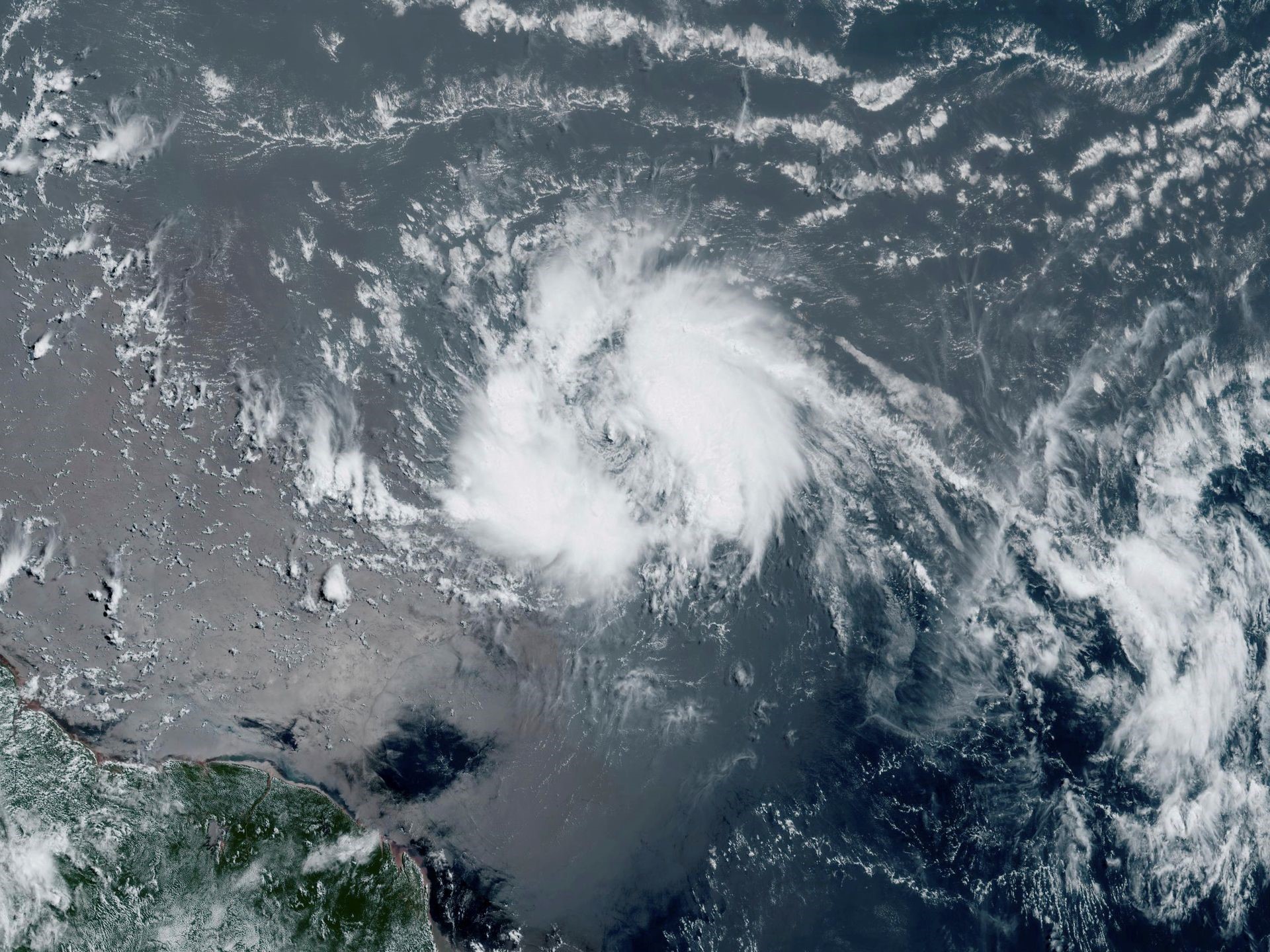
(Trinidad Guardian) Although it poses no direct threat to Trinidad and Tobago, all eyes are on Tropical Storm Bret, which was located just over 1,300 kilometres east of Tobago yesterday evening. Tropical storm watches have been issued for Barbados and Dominica, where tropical storm conditions are possible on Thursday.
According to the National Hurricane Centre (NHC), yesterday, Bret moved quickly west near 30 KM/H, and this general motion is expected to continue through the next several days. The NHC said, “On the forecast track, the centre of Bret is expected to move across portions of the Lesser Antilles Thursday afternoon and Thursday night, and then move across the eastern Caribbean Sea on Friday.”
Tropical Storm Bret strengthened over a 24-hour periods, with maximum sustained winds of 75 KM/H and higher gusts. The NHC forecasts additional strengthening Wednesday, and Bret will remain a tropical storm when it reaches the central Lesser Antilles by Thursday into Thursday night. Bret remains a small tropical storm with tropical storm-force winds extending 75 kilometres outward from the centre.
The NHC said, “Bret is forecast to approach the Lesser Antilles through Thursday morning and then move across the islands Thursday afternoon and Thursday night as a tropical storm, bringing a risk of flooding from heavy rainfall, strong winds, and dangerous waves along the coast.”
At the time of the storm’s passage across the Lesser Antilles, the NHC is forecasting Bret to have sustained winds up to 100 KM/H and gusts to 120 KM/H. Through Saturday morning, storm total rainfall amounts of four to six inches (100-150 mm) with maximum amounts of 10 inches (250 mm) are possible across portions of the Lesser Antilles from Guadeloupe southward to St Lucia. The NHC adds that rainfall amounts of two to four inches (50-100 mm) are possible across Barbados and St Vincent and the Grenadines. The heavy rainfall could lead to flash flooding, especially across areas of higher terrain, with isolated urban or street flooding possible.
For T&T, however, there are no alerts, watches or warnings in effect from the Trinidad and Tobago Meteorological Service (TTMS). Their official statement on the system stated, “The TTMS wishes to underscore that this system poses no immediate threat to Trinidad, Tobago, Grenada and its dependencies.”