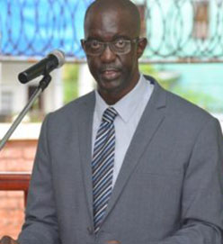
With over 30,000 land applications on file at the Guyana Lands and Surveys Commission (GL&SC), government is preparing to open new areas for development across the country, GL&SC Commissioner Trevor Benn says.
“As a country, we have not opened up new land development areas since the late 1960s. We have over 32,000 applications and every day [we] receive hundreds more, so we will be opening new lands soon,” Benn told Stabroek News in an interview. “We have to open new areas and that is a priority at this time,” he added.
Benn would not give details of where the new developments are located as he pointed out that it could lead to a flood of new applications—a situation that the agency, with already limited resources, doesn’t want at this time. He explained that when persons heard of locations where the proposed natural gas pipelines are to be landed onshore, as well as other planned oil and gas developments government has planned, there was “a flood of applications for those areas.”
Government is aware of the demand for land and that persons sometimes turn to squatting given the shortage, he said.
“We have a large scale squatting problem and the reality is that lands are not really available in areas that people want land. We just don’t have the lands in Region Four and other regions, and some issued here were not done in a structured way. It is not healthy for a country to be distributing land resources in that way. So, we are working on a plan with structure,” he added
Persons have lamented the sloth by the GL&SC in processing their applications, with some saying they have applications that are over a decade old on file at the agency.
Benn said that many persons are quick to blame the commission for the delays in the process but when he took over the agency in 2017, he realised that part of the problem was due to the fact that the processing was done manually.
“When I arrived here, we had over 32,000 applications waiting to be processed and every day we literally received hundreds more. All of these are processed manually. The process is that somebody visits and states their interest in a specific area, leave a letter and that letter is noted and filed. That person is invited to come in and pay the requisite fees, including an inspection fee. We determine if the land is available if there is any encumbrancer on the land. We have to go out in the field because we don’t have an electronic system that captures ready field information,” he explained.
“Every application is done by somebody on a desk and we don’t have enough bodies. We are working to (digitise) the system. So, we have to scan all those documents manually; every file. We can’t process using the same method they had that is archaic, so we are moving to computerising. Also, we don’t have updated maps. You should have updated maps from which you do surveys and here we are doing surveys on old maps and they are not 100 percent accurate because of that. This is the only land agency that doesn’t have a drone. Many land agencies, even in the Caribbean, have their own boats, choppers, planes and those things. We don’t have any of those things and that is a setback. But the work must be done so we are working with what we have until we are there,” he added.
He said that some of his staff members are not happy with the amount of work they have to do in order to digitise the information but the work has to be done if the agency is to meet 21st century demands.
To update the country’s base maps, according to Benn, would cost an astounding £12 million and that is money that they agency doesn’t have. He reminded that when he took over, the GL&SC had a negative balance of over $200 million and although there is now a surplus, it is nowhere near the £12 million needed to update the maps.
The GL&SC is already receiving some help to transform current land management practices here and to ensure sustainability in land management systems under a four-year US$14.8 million Mainstreaming Sustainable Land Development and Management Project, which began this year.
Components of the project include: land reclamation and development, implementation of a land classification system, and other requirements to facilitate optimal land utilisation and sustainable land development and management.