MONTPELIER, Vermont, (Reuters) – A dam upstream from the Vermont state capital was holding a t maximum capacity yesterday after “catastrophic” flooding shut down roadways leading out of Montpelier and trapped people in their homes.
The Wrightsville Dam, which forms a reservoir four miles (6.4 km) north of Montpelier, neared the point at which a spillway would need to release water into the North Branch of the Winooski River, city officials said.
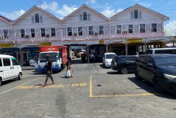
That would aggravate what the National Weather Service has called “catastrophic” flooding in Montpelier’s picturesque downtown district, where people navigated the submerged streets in canoes and floodwaters reached the windows of businesses and the tops of vehicles.
The North Branch converges with a second, larger branch of the Winooski near the Vermont statehouse.
The growing frequency and intensity of severe weather across the United States is symptomatic of global, human-driven climate change, climate scientists say.
While a Northeast state capital is under water, ocean temperatures have soared to as high as 90 Fahrenheit (32 Celsius) in Florida, Texas is sizzling under a heat dome, and California is bracing for temperatures as high as 120 F (49 C) in desert areas this weekend.
Much of the U.S. Northeast including parts of New York, Massachusetts and Connecticut have already had as much as 8 inches (20 cm) of rain over the last several days.
“Make no mistake, the devastation and flooding we’re experiencing across Vermont is historic and catastrophic,” Vermont Governor Phil Scott said at a briefing Tuesday.
Montpelier City Manager William Fraser in a Facebook post urged the city’s 8,000 people to be prepared to move to the upper floors of their homes as highway closures made evacuations difficult or impossible.
Throughout the state, search teams have rescued 117 people from their homes and cars by swift boat, as officials fielded calls that even more people were trapped in their homes in remote areas, Mike Cannon, leader of the state’s Urban Search and Rescue operation, told a briefing.
Vermont officials called the flooding the worst since Hurricane Irene reached the New England state as a tropical storm in 2011 and caused about $750 million in damages and seven deaths in the state.
The city’s topography – bordered by hills with the downtown in a valley – increases the potential for flooding, Montpelier City Council member Conor Casey said.
“My wife and I live right on the river and it’s about two feet from coming in the living room,” Casey said. “We’re a bit used to it from Irene, so it’s not totally foreign, but I think the scary thing is that it feels a bit worse so far.”
The flood took its toll on the regional economy, with private forecaster AccuWeather estimating damages and economic loss at $3 billion to $5 billion.
Most of the crops at Boyd Family Farm in Wilmington, Vermont, were lost in the storm, said Janet Boyd, who owns the 80-year-old business along with her husband and son at the southern end of the Green Mountains.
“We lost all the vegetables and only have our blueberries left,” Boyd said, “all the greens, the tomatoes, the peppers, the garlic.”
Joe Miles, 59, owner of the Montpelier-based R.K. Miles Building Materials, said three of his eight locations in the state were heavily damaged, with two of them cut off by flooding.
Much of his lumber and plywood inventory was lost to water damage.