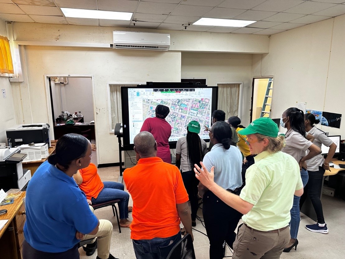
Twenty-five employees of the Guyana Lands and Surveys Commission (GLSC) recently underwent training on land mapping techniques and administration.
The training was provided by Medici Land Governance (MLG) which is based in Utah in the US.
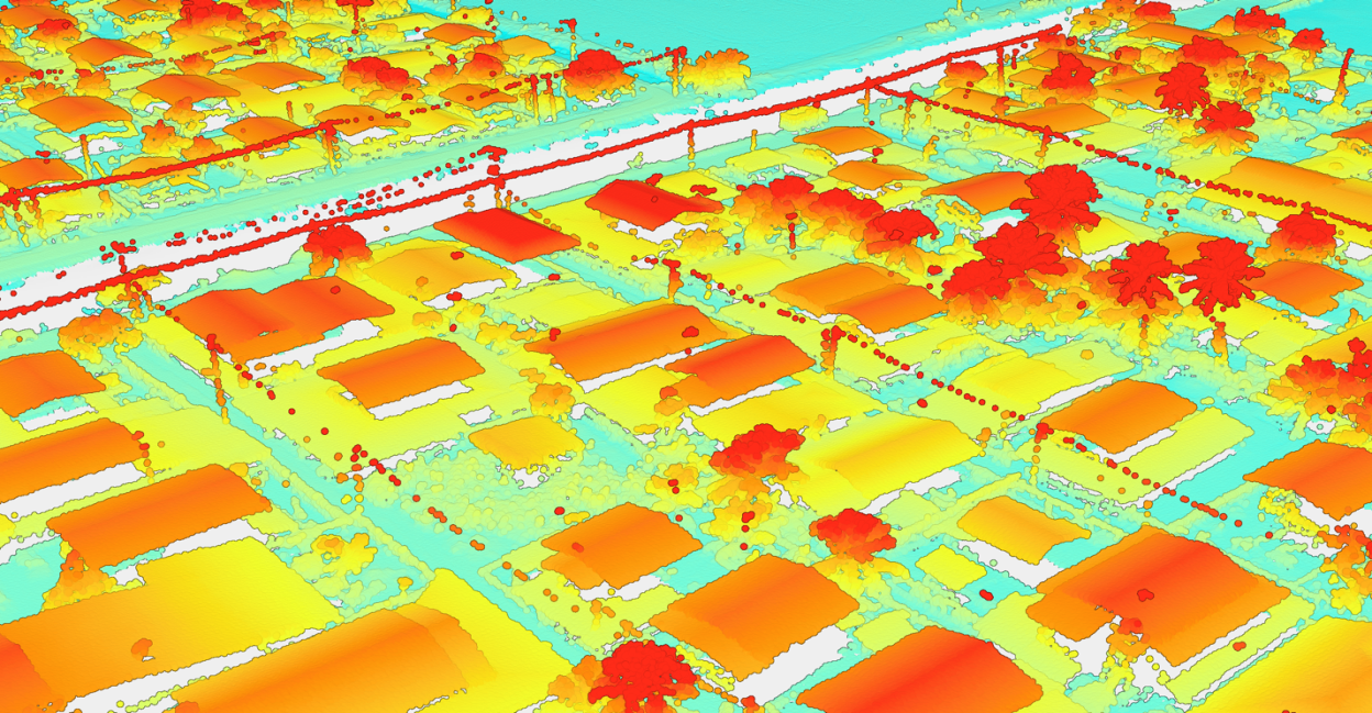
A press release yesterday from MLG said that it recently completed a critical capacity building and training phase, which involves LiDAR (Laser Imaging, Detection, and Ranging) technology to develop accurate contemporary maps of the country’s land surface.

This was done in conjunction with Guyana’s Sustainable Land Development and Management (SLDM) Project which aims to modernize land management and update its national map to meet objectives in urban growth and economic development.
The release said that MLG’s data capture and digitization project manager led a group of 25 trainees in advance implementation of LiDAR technologies, applications for land administration, and tools and workflows for acquiring, processing, and analyzing LiDAR data. The group comprised Geographic Information System (GIS) analysts and technicians, and surveyors of the GLSC.
The release said that the training complements the aerial data acquisition phase by MLG and its partners for Guyana’s Mainstreaming SLDM Project which is funded by the Guyana REDD+ Investment Fund (GRIF) and implemented by the UN Food and Agriculture Organization. The release said that MLG is leading the production of updated map data and will process aerial imagery data to produce digital terrain models and map imagery for extracting infrastructure, water features, and 3D building models. The data representing terrain, aerial imagery, and extracted features will become vital layers in the national map. The project covers 545 km2 of the urbanized area (nearly all of Guyana’s urban footprint) and another 15,736 km2 of rural area.
LiDAR’s mapping capabilities are achieved by emitting laser pulses from an aircraft or ground-based system and measuring how long it takes for the light to bounce back to a sensor. With these data points, the release sad that LiDAR can generate a precise three-dimensional map of the land and everything on it, including trees, buildings, easements, walls and rivers. LiDAR is described as a cost- and time-efficient alternative to traditional mapping methods.