 By Ulric O’D Trotz
Now retired, Ulric (Neville) Trotz was formerly the Deputy Director & Science Adviser, Caribbean Community Climate Change Centre, Belmopan, Belize
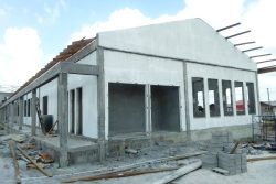
As Guyana invests in an aggressive program of infrastructure development in its inhabited coastal zone, it is incumbent on all involved to ensure that the proposed interventions have minimal or no adverse environmental impacts on the prevailing environment and that they are sustainable and can withstand future environmental changes.
To ensure that development does not result in environmental degradation, leading to a loss of key ecosystem services and exposing communities to the impacts of the latter, it is now common practice to require developers to conduct Environmental and Social Impact Assessments (ESIAs).
The United Nations Environment Programme (UNEP) defines Environmental and Social Impact Assessment (ESIAs) as a tool used to identify the environmental, social and economic impacts of a project prior to decision-making on its implementation. ESIAs aim to help the developer predict environmental impacts at an early stage in project planning and design, find ways and means to reduce adverse impacts, shape projects to suit the local environment and present the predictions and options to decision-makers.
In some cases, due to the findings of an ESIA, decisions are made to abandon the project altogether. By using ESIAs, both environmental and economic benefits can be achieved, such as reduced cost and time of project implementation and design, avoided treatment/clean-up costs and impacts of laws and regulations.
The ultimate aim of the exercise is to ensure that development does not compromise the integrity of the local environment to the detriment or inconvenience of the community and is in full compliance with national laws and regulations designed for that purpose.
In the past two decades, we have seen the emergence of the threat that a changing climate poses to global development agendas.
Rising global temperatures, changed weather patterns, increased intensity of extreme events, rising sea surface temperatures and sea level rise, have been playing havoc with our developmental aspirations. Guyana, like other developing countries, bears the brunt of the impacts arising from global climate change, which is now regarded as the most serious threat to the successful attainment of our sustainable development goals.
Countries are now obliged to integrate climate risk assessment into their national development plans, a requirement that is tantamount to turning the ESIA paradigm on its head by asking the question “what impact will future climate and climate change have on my development plan?”
In other words, will the planned development be able to withstand the impacts of climate change? The latter should be of paramount concern to the developer who would be interested in the long term sustainability of his/her/their investment. Effective implementation of ESIAs ensures that at the end of the day the concerns of all involved – the governing entity, communities likely to be impacted and the developer – have been meaningfully taken into account and measures incorporated in the implementation phase, to mitigate the impacts of those concerns.
ESIAs must not be considered as obstructionist by any of those involved, but rather as an enabling mechanism that usually leads to a more satisfactory outcome for all of those involved.
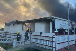
The focus of Guyana’s development efforts are in a coastal zone which occupies about five per cent of the country’s area, is home to more than ninety percent of the population, is 1 to 1.5 meters below sea level and is highly vulnerable to climate change impacts. Global sea level rise and the changing rainfall patterns will exacerbate the risk of inundation on Guyana’s coast, as evidenced by the ever increasing cycle of floods and droughts that pose serious challenges to the country’s development programmes.
It is therefore in the interest of the government, citizens and investors to secure their investment in coastal infrastructure by carrying out climate vulnerability assessments on their development plans.
Information from the latter can then be used to determine what steps ( possibly design adjustment, change of locality) need to be employed to mitigate the climate risks identified.
Financial organisations now ask for their clients to conduct climate vulnerability assessments on their proposals and to ensure that, if necessary, they make the appropriate adjustments in their final design, to mitigate the projected climate risks that are identified.
The Caribbean Development Bank requires applicants for financial assistance for infrastructure and other climate sensitive projects to carry out climate vulnerability assessments and to address the mitigation of identified climate risks in their final proposal.
Indeed, the Caribbean Development Bank (CDB) provided funding to address the high incidence of damage to the road infrastructure in Caribbean countries by natural hazard events and the potential for the loss of roads by rising sea levels. Through a technical assistance project, the Bank funded a study on approaches for mainstreaming climate resilience into the road transport sector in its Borrowing Member Countries (BMCs).
These are supposed to develop and pilot approaches for constructing road infrastructure that is resilient to natural hazards and climate change. This was in response to the observation that each year, transport infrastructure in the Caribbean and particularly road infrastructure, suffers substantial damage as a result of natural hazard events, with flooding being among the most frequent and costly of events.
Also, the threat to road transport infrastructure is heightened by the projected effects of climate variability and climate change, particularly increased intensity of rain storms, sea level rise, and increased ambient temperatures.
In terms of their long term sustainability, all infrastructure projects being implemented on Guyana’s already vulnerable coast – shore based facilities for the oil industry, natural gas facilities, hotels, roads , bridges, health and educational facilities etc. – should incorporate climate risk mitigation considerations in their final design. This requires utilising information on future regional climate scenarios that are now more available and the necessary tools to carry out such analyses.
The CDB has worked with the regional Climate Change Centre in Belmopan, Belize, and other regional stakeholders to incorporate climate risk assessments in the ESIA process.
The Climate Change Centre has also developed a climate risk assessment tool that allows for the identification of climate sensitive areas of activity, for the identification of the climate risk and its quantification (as far as available data allows), and for identifying mitigative options (adaptation) for implementation. Just as an illustration, drainage engineers in designing drainage systems usually base their design on the consideration of past rainfall patterns that allows them to estimate the volume of water that has to be managed.
This is no longer a valid approach and they are now required to use the projections of future rainfall patterns , with the significantly higher volumes of water being generated, if the proposed system is to be effective in preventing inundation and consequent damage.
Given the pervasive climate vulnerability of Guyana’s coast and the level of development now taking place, Guyana should fast track actions on a comprehensive overhaul of its sea defence and drainage and irrigation systems for the entire coast.
This is not to be done in a piecemeal fashion but rather, through a country wide scientific assessment of the present and future risks to which these systems are exposed, and to use this knowledge to develop appropriate climate resilient designs for implementation.
Sea defence and drainage and irrigation have already been identified as priority areas for action under Guyana’s Low Carbon Development Strategy (LCDS) and should be expedited and by so doing, remove a major threat to the future sustainability of coastal infrastructure and also to other climate sensitive socioeconomic sectors that our livelihoods depend on.
The Guyana Lands & Survey Commission (GLSC) and the Food and Agriculture Organization of the United Nations (FAO) are carrying out an aerial survey and mapping across the country, using Light Detecting And Ranging (LiDAR) Technologies.
This activity is part of the objectives of a Sustainable Land Development and Management (SLDM) project, which seeks to advance technology in land management and development. According to the organisers, the data collected will be processed to produce digital terrain models and map imagery for extracting data on infrastructure, water features, and 3D building models.
The resulting data will then be entered into key layers to update the national base maps, which are over 50 years old. At the end of this exercise, over 500 square km of the urbanized land area (nearly all of Guyana’s urban footprint) and over 15,000 square km of the rural area will be surveyed using this new technology.
Guyana should take the opportunity to utilise the LiDAR facility to provide topographic maps for all areas in the coastal belt that are earmarked for further development – settlement, agriculture, infrastructure. These can then be processed to provide the country with authenticated flood risk maps that would inform future investment decisions in the coastal zone.
These are the issues: Addressing coastal vulnerability issues through building climate resilience in coastal sea defence and drainage systems; preparing comprehensive Flood Risk Maps of Guyana’s coastal belt; and ensuring that development plans benefit from the integration of climate risks in their final design and from carrying out Environment and Social Impact Assessments on development proposals.
Such an approach places everyone – government, citizens, investors – in a win-win situation, where development does not have adverse effects on the environment, does not compromise the health and well-being of its citizens, and where investments in the future are secure from the ravages of a changing climate. For a country whose capital city is predicted to be among 30 that will be underwater by 2030, the stakes could not be higher.
It is in the interest of all concerned that these principles inform the way we do business that is environmentally benign and climate resilient , in the transformation of our fragile coastal zone in Guyana. To quote the bard, Martin Carter, “All are involved , all are consumed.”